Thursday, November 28, 2019

TD2 2019 Adventure - NV - Dave & Susan visit

We arrived in the afternoon, and were greeted by David and Susan's chickens.

Since then we've take a couple of hikes (Red Canyon and Rickey's Canyon) with Dave, his neighbors and their dog "Dawg".  What a good boy!

Also got a look at their Mongolian yurt, and helped recover it before the snow was scheduled to fall.  Alas, our sunny weather was finally coming to a close.

But that is giving me time to catch up on photo reviews, making these albums, getting them somewhat annotated, and fire up the Thistle Dew Too blog.

Hey, it's a start ;-)

Gratuitous animal photos:

Meanie, Meanie, Tetrazzini

Dawg's a Good Boy!


And here's the album for our visit so far:

https://www.flickr.com/photos/crisp_travels/albums/72157711958862088

Tuesday, November 19, 2019

TD2 2019 Adventure - CA - Yosemite NP, Day 2-3 and Lake Mono Picnic Area

Our campground was chilly (underneath tall Sequoias, so not much sun), and there are no electrical hookups available anywhere inside Yosemite.

But we survived fine, even on the second night when it got down to 20 degrees!   Thank goodness for the down comforters we've had since our first tour in Germany.

Our first hike was something of a cluster, as the park ranger had sent us toward Mirror Lake (even though it was dry), because she apparently intended for us to walk across it; we missed that tip, and too a long loop around the "lake".  What was supposed to be a 5-6 mile hike turned out to be about 9 miles.  No big deal, but not really all that scenic.

After that, we heard that Tioga Pass was likely to close the next day, and although there are alternate ways out of Yosemite, none are as convenient to reach Carol's brother's house -- our next destination.

So we actually cut our visit short 1 night to beat the snow, and as such, there is much left to see on another visit or three.

And we had nice views of Half Dome and El Capitan, followed by yet more scenery along Tioga Rd.  That is simply amazing!  Finally, we ended up on Rt 395, and stopped for brunch at Lake Mono (long "o" on both sylables) Picnic Area -- a very interesting place.

Then off to Nevada.

Teaser photos:


Carol at Mirror "Lake"

El Capitan Illuminated!

Mono Lake Tufa Towers

Album containing all the photos:

https://www.flickr.com/photos/crisp_travels/albums/72157711958961853

Sunday, November 17, 2019

TD2 2019 Adventure - CA - Yosemite NP, Day 1 - Amazing drive on Tioga Rd

We took advantage of what looked to be the end of our amazing run of sunny days.

We noticed that the Tioga Pass (just under 10,000 ft) was still open, offering a scenic entry into Yosemite National Park.  We found they had a few spots available in Upper Pines Campground, so we made our way there.

After staying at June Lake and having an enjoyable morning there, we took our time on the Tioga Rd and really enjoyed the scenery.  What a magnificent entrance to Yosemite!  And what spectacular weather (note the topless man relaxing around 9,000 ft elevation ;-)

By the time we arrived in Yosemite Valley, the sun was already starting to set, so we had nice illumination of Half Dome, and made our way to the Visitor Center and our camping spot.

Teaser photos:

Heading up to Tioga Pass

Sunset on Half Dome

And here is the album from Day 1:

https://www.flickr.com/photos/crisp_travels/albums/72157711956965477

TD2 2019 Adventure - CA - June Lake and the Ducks!

After leaving Death Valley, we drove on Rt 395 and wanted to find a campground close to Tioga Pass, so we could enjoy the scenery heading into Yosemite National Park.

We tried stopping at a place called the Devil's Postpile, but they were closed for the season.  So we headed to June Lake, which we had visited on a previous trip.  Turns our their campground was closed as well, be we found another RV located in the parking lot by the lake, and the nice German couple said they received permission from the visitor's center to boondock there.  That was good enough for us.

And what a beautiful morning we had (after a chilly night) on the lake, visiting the ducks and getting down to sand level to take some pictures.

This was the perfect place to stay before heading up to Tioga Pass!

Some teaser photos:

Boondocking at June Lake!

Here come the Ducks!
And here is the album for those that are interested:

https://www.flickr.com/photos/crisp_travels/albums/72157711963458488


Saturday, November 16, 2019

TD2 2019 Adventure - CA - Death Valley

On our way out of the Mojave National Preserve, we took a wrong turn and ended up in NV on the way to Las Vegas.  So we turned around, but decided to spend the night at Buffalo Bills Casino (where we found a Denny's of all things).

Crossing back into CA the next morning, we noticed the Stateline Solar Farm which looked intriguing.  Next, since it had been pretty chilly at night, we figured it might be good to head to the hottest spot in the US:  Death Valley.

It was pretty cool (yet warm ;-).  I never realized how large this place was.  We decided to drive through Badwater (lowest spot in US), and largely followed the course of the Badwater 135 Ultramarathon, held every July!!, running from Badwater up, down, and up, up, up to the trail head of Mt. Whitney in Lone Pine, CA,  That's simply insane!

Alas, there was no RV parking at the salt flats in Badwater, so that will have to wait for another time.  Thistle Dew Too deserves kudos for handling those steep up and down grades coming out of the Death Valley.   Way to go, girl!

Another teaser photo:

Laundry anyone?  Perhaps a ride?

And here is the album for those who are interested:

https://www.flickr.com/photos/crisp_travels/albums/72157711958314693

Thursday, November 14, 2019

TD2 2019 Adventure - CA - Mojave National Preserve and the Hole-in-the-Wall Campground

We spent a couple of nights at the Lazy Daze factory getting some work done on Thistle Dew Too, and buying a bunch of pre-emptive spare parts, "just in case".

Then it was time to get out of Southern California (let's just say it is not on our list of possible new home locations ;-).

So to get away from the crowds, we made our way to the Hole-in-the-Wall Campground inside the Mojave National Preserve.

We really liked the place, and hiked both of its loop trails:  Barber Peak Loop Trail and Rings Loop Trail.  They both actually end up near the Rings, so you'll see some photos of each of us climbing out of the canyon from both days, depending on who was taking the pictures.

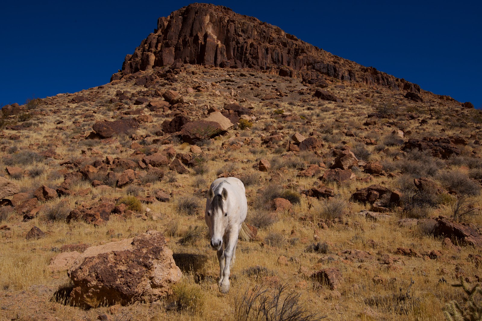
Very nice hikes, and very interesting rock formations.  And as my new half-brother David said when I sent him a few of these pics "Hey, is that your Spirit Horse?"  I don't know, but it was really amazing to stumble upon 4 or 5 grazing horses of different colors, and have the white one come over to me and say "hi".

As we departed the campground we were greeted with a spectacular sunset among a very large Joshua Tree "forest".  Alas we had little time for pictures as we were running out of daylight to get off a lengthy washboard road.  But we made it!

Teaser photos:

A gem amongst a field of gold

My Spirit Horse

And here is the photo album for this nice visit:

Sunday, November 10, 2019

TD2 2019 Adventure - CA - Palm Springs & Lake Perris, meeting our half-brother

So this is quite a story.  We were on our way to see my sister when she received an e-mail from someone on Ancestor.com that she may have a unknown cousin.  Then it turns out -- not a cousin but a half-brother.  Which means ... that I also have a half-brother.

After digesting this information, we make arrangements to meet our half-brother David, and some of his family.  All of our respective parents are gone at this point, so we can't gather any additional details, but we also get to avoid some really awkward conversations ;-)

Hey, it's always exciting to enlarge the family tree!  So now it's time to meet "a brother from another mother" ;-)

Here's our enlarged family photo:

Meet David, our "brother from another mother"!

Here are some pictures from our visits in Palm Springs and at Lake Perris:

https://www.flickr.com/photos/crisp_travels/albums/72157711745282432

Thursday, November 7, 2019

TD2 2019 Adventure - AZ - Grand Canyon, Day 2 -- Sunrise, Sunset, and down into the Canyon

Our second day included Steve heading out solo to watch the chilly sunrise and sunset.  Not spectacular due to the lack of clouds, but still worth the extra activity.

Then we decided to descend a bit into the canyon via the South Kaibab Trail to get the feel of it (especially the return hike uphill).  Our target was aptly named the Ooh Aah Point (sounded worthy of the effort).

This time of year is perfect from a temperature perspective to hike down the canyon.  And we enjoyed it enough that at least Steve (and maybe Carol) can envision a hike down to the bottom of the canyon, assuming overnight accommodations are planned in advance.

We'll see -- it's on someone's bucket list. ;-)

Here's the aptly named Ooh Aah Point and a sunset canyon glow:

Aptly named Ooh Aah Point

Grand Canyon Sunset Glow

And here is the photo album, probably the most photos I kept from a shoot:

https://www.flickr.com/photos/crisp_travels/albums/72157711954772801

Wednesday, November 6, 2019

TD2 2019 Adventure - AZ - Grand Canyon, Day 1 - simply amazing weather!

After much hemming and hawing, and checking of weather forecasts (since night-time temps were looking pretty low), we decided to make another assault on the Grand Canyon.

We secured a campsite for two nights, and boondocked not far from the park the night before arrival.  It was a great spot, and our first 2019 campfire was lit, just for the heck of it.

Weather during the day was absolutely perfect at the Grand Canyon, and we mostly just walked along the South Rim Trail this first day.

Pretty amazing views for a really large hole in the ground, or as I heard a park ranger tell someone when asked for the best place to see the grand canyon, "hey, it's the same hole, just different angles." ;-)

Here's a gratuitous Grand Canyon overlook photo (plus a humorous dog):

Carol & Steve cling to the edge and each other!

He's a looker, alright!
It's a Dog's Life!

And the photo album for those so inclined:

https://www.flickr.com/photos/crisp_travels/albums/72157711820985252

Monday, November 4, 2019

TD2 2019 Adventure - AZ - Red Rock Crossing

Our next stop was at a place recommended by my sister and BIL, called Red Rock Crossing.

We found it inside the Crescent Moon Ranch by taking the Budda Beach Trail (not Buddha, as I originally saw ;-)

There used be a low-water crossing area that cars could use to ford Oak Creek.  While that is no longer in existence, we found some trees and a makeshift handrail that we used to get across, which took us on the Templeton Trail (a wonderful rock ascent trail, shared with some intrepid mountain bikers).

It made for beautiful views, and great exercise.  More climbing could have been done on the Cathedral Rock Trail, but we were still working up our stamina, so we let discretion be the better part of valor ;-)

Here's a couple of teaser photos:

Steve above the Fall Foliage

Northern Mexican Gartersnake

And here is the complete photo album, if so inclined:

https://www.flickr.com/photos/crisp_travels/albums/72157711956441272

Sunday, November 3, 2019

TD2 2019 Adventure - AZ - Tonto Natural Bridge State Park

So our next stop was at the Tonto Natural Bridge State Park in Pine, AZ.  We decided to buy an AZ State Park annual pass, as we figured we would get some use on this trip, and likely next year as well.

We followed the Ana Mae Trail to some incredibly smoothed (and slippery, even when dry) rocks, and had this interesting view of a natural travertine marble arch bridge that you could look through and see a small waterfall cascading in the sun.

The full loop trail was closed, so we decided not to venture too much further (which would have provided better photos given the afternoon sun), but still had an enjoyable hike.

I'm still amazed that people aren't sliding down these smooth rock faces and hurting themselves on a regular basis.  Be sure to wear grippy footwear if you hike this one!

Here's a sample photo:

Travertine Marble Arch Bridge, Waterfall, and Reflection

And here is the full album, if interested:

https://www.flickr.com/photos/crisp_travels/albums/72157711955964886

Saturday, November 2, 2019

TD2 2019 Adventure - AZ - Dropping in on my sister and BIL

By this time, it had turned cold across most of the country.   Originally we were heading for Albuquerque, but we needed to get further south.  So we made arrangements to head to my sister's home in Scottsdale, AZ.

There we had some great meals and conversations with Linda & David, but largely left the camera at home, except for few walks and visits.

Here we learned the fascinating news that my sister and I likely had a half-brother!  So before departing, we made arrangements to meet him and some of his family the following weekend (more on that later).

So we're off for a few more Arizona adventures in the meantime.

Desert Roadrunner on one of our walks

Brief photo album can be seen here:

https://www.flickr.com/photos/crisp_travels/albums/72157711813025766

Monday, October 28, 2019

TD2 2019 Adventure - NM - Finally some real boondocking in New Mexico

Now into New Mexico, we decide to stop at the White Sands National Monument.  Which was fortuitous, since it was in itself interesting, but more importantly, we got a great tip on a boondocking spot not too far away.

The Aguirre Springs Campground located on BLM land would never have been found otherwise.  Technically, our RV was a little bit above the maximum length recommended for the road, but it was no problem (we didn't see the sign until we departed, as we arrived after dark).

We had a great hike on the Pine Tree Trail loop, which had good elevation gain, and interesting scenery, vegetation, gnarly trees, and interesting rock formations.  It made for some enjoyable exercise!

Here is the teaser photo:

Skeleton on the Pine Tree trail
And for more photos from White Sands National Monument and the Aguirre Springs Campground, check out this album:

https://www.flickr.com/photos/crisp_travels/albums/72157711813498777

Saturday, October 26, 2019

TD2 2019 Adventure - OK - An OK state (get it?), and a few more pictures

Our next photo stop is the National Route 66 Museum in Elk City, OK.

We arrived late, but had enough time for a quick visit of their various museums, along with the offer to adopt two adorable barn kitties (which we had to decline ;-)

Here's the teaser photo:

Anybody want some kittens?
And here is the album with a few more photos:  


Wednesday, October 23, 2019

TD2 2019 Adventure - IN, IL - Where are the picture albums already???

OK, OK, I hear you.

Now that all of the backstory is out of the way, did we ever start taking any pictures?

Not until we headed backwards a bit -- back to Indiana -- and decided to camp at the Brown County State Park in Nashville, IN.

And even then, we only started taking pictures on our way out of the park and heading into Illinois.

Our second brief photo op was at a lunch spot in a state park and town by the same name -- Cave-in-Rock, right along the Ohio River.

Here's one picture from the album where you can see them all:

Cave-in-Rock State Park, IL
For the rest of the photos, please visit my Flickr album:

https://www.flickr.com/photos/crisp_travels/albums/72157711813089411

Sunday, October 20, 2019

TD2 2019 Adventure - NH - Getting Thistle Dew Too on the Road

So up at our cottage, our first job was to prep Thistle Dew Too with food, water, and all of the other regular essentials.

After that, we needed to close up the cottage and try to keep the mice at bay over the winter (good luck with that!)

Thistle Dew Too was having an issue with her levelers.  They weren't getting power, and I had "jumped them" to retract them most of the way.  No one could explain where I might find the circuit breaker that probably needed to be reset.  So, alas, we had to make an appointment at the Big Foot factory in White Pigeon, MI.

We were all set to go and have a leisurely 4-day trip to Michigan, except when I unplugged from shore power, the inverter was suddenly not working properly, even after I reset it.  We rely quite heavily on our inverter, so we delayed our departure to try and figure it out.  Finally, we decided to leave anyways, and now having lost a couple more days, we needed to drive straight to Michigan via highways, spending an overnight in a rest area (not the way we prefer to travel).

But we made it to the appointment, they found the self-resetting circuit breaker that was heavily corroded (located behind the generator for some unknown reason), replaced it, and the system was working fine!

After that, I used at tip from Jane on LazyDazeOwners forum to check the fuse between the batteries and inverter, and sure enough, the 200 Amp Class T fuse was blown (for some as-yet-unknown reason).  After replacing it, we were back up and fully operational.

Next stop ... somewhere to start unwinding!!!

Gratuitous cottage pond photo:

Reflections of Beauty!

Friday, October 11, 2019

And now for the Thistle Dew Too (TD2) 2019 Adventure ... But first ... a Prologue

I'm going to admit upfront to writing most of the 2019 Adventure's blog posts "post facto".

What can I say -- it was a trying year.  Let me explain:

WE SOLD OUR HOUSE!  Need I say more?

And it was an exhausting, stressful, and seemingly endless process.  But other than that, it was great ;-)

This was our Amherst, NH home where we have lived for the past 25 years, and the town we have lived in for almost 35 years.  It is where we raised our family, and where we lived when we lost our parents (and gained their possessions).

We loved this house, the yard, the privacy, our neighbors -- we loved everything about it.  Except an interesting thing happened following my retirement.  Now that I had the time to work on the yard, and even though I liked working in the yard once I got outside, I did not want to *have* to keep up with the yard, the house maintenance, etc.  (And yes, I do realize this is a FWP -- First World Problem ;-)

So after moving back home in 2016, and allowing time to see where our noses would lead us, Carol and I both came to the conclusion that we should sell our home.  I believe this happened while lounging in our hot tub, another reason we loved our home ;-)

This resulted in major upgrades and improvements since it had been neglected during the rental years when we were on overseas assignment, and culling, culling, culling almost all of the stuff we had accumulated over the years.  Then keeping the house spotless while showing it (and while we still lived in it).

Sure enough, one family saw our house soon after we listed it, but was worried about the commute.  Yet every other house they looked at (~ 50, we were told), came up short when compared to our house.  And so they finally made an offer, and we established a relationship, and this culminated in a mutually beneficial transaction for all parties.  We *love* the new family that now calls our old home their new home.  And we are so happy for them!

That said, we were still moving our remaining belongings into a storage unit at 11:00 PM the night before the closing.  Did I mention stressful and exhausting?

After the closing, we headed up to close up our summer camp, to get Thistle Dew Too ready for her new adventure.  More about that next.

Gratuitous house-related photos:

Thistle Dew Too's previous "home pad"

Our relaxing hot tub, where all important decisions were made!

Our beloved home for 25 years - thanks for the memories!

Friday, September 7, 2018

Week #7 - Labrador or bust! (and maybe Quebec)

The journey continues and so do the photos!  If you wish to skip the banter and jump straight to the photos, please go here: https://www.flickr.com/photos/crisp_travels/albums/72157699489769351

This week we took the plunge and decided to drive through Labrador and begin our journey home.  One thread you can weave in this batch of photos is about the roads.  They are all over the map (so to speak ;-)  We’ve now covered all the roads in Labrador (meaning Routes 500 and 510), and most of the route through northern Quebec on our journey back to civilization (Rt 389), and I think we’ve seen it all.  You’ll see quite a few samples of the road conditions.  But the bottom line is that it is much better than the internet would lead one to believe:  we found no tire-eating pot holes; no need for a loaner satellite phone; and the washboard is reasonably infrequent and short.  Indeed much of it is newly paved and in great condition!  But I will note that there will be some rocking and rolling for an RV-sized vehicle.  In fact, this morning I found two of the screws that fastened our home-made pantry to the wall had sheared off.  Luckily noticed that before it completely separated from the wall or that would have been a real mess!  All secured now, but just a reminder of how strong the lateral and vertical forces can be, even though they are thankfully infrequent, in case you’re considering an excursion of your own.   

So we started this weeks adventure from Red Bay, Labrador, where we checked out their Whaling exhibit.  Quite informative, as were many of the places we visited this week.  So you will find more placards and background information in the photos, if you wish to learn more about the places we visited.  If not, feel free to skip through and just check out the scenery.  Next was a nice hike up Tracey Hill, and a new record — 689 stairs!  (We had to look up that number as we each counted and kept getting different answers - I considered that my day’s meditation ;-)  Then we were off to Mary’s Harbour, and made a “follow-our-nose” decision to take an overnight excursion to Battle Harbour. We did this because it had been recommended by a few people, the weather forecast looked good, and hey, we had the time ;-)  It’s a bit pricey, but we were happy to learn it really all goes back to the community to keep the facilities up and many locals employed.  We were also able to park in their lot for two nights, and did a short hike to White Water Falls while waiting for a parking spot to open up for us, where Carol made us some yummy veggie pizza!

The ferry ride is about 90 minutes one way, and a little bit “rocky” — we stayed outside in the back, and it was no problem.  Once we arrived and dropped our belongings in our room, we had a leisurely 3-hour tour led by Nelson Smith who grew up living between Battle Harbour and Mary’s Harbour as many locals did after Government resettlement in 1960.  As a former fisherman, he was able to share the old tools and techniques of his time, and that of his forebears, and the harbour buildings have been well preserved.  Again, you will see lots of information in these pictures, that will give you a good feeling for what it was like living here 100-150 years ago.  You’ll also see a small plane crash memorial, and it turns out Nelson and one other kid were the people who found the crash (which occurred due to heavy fog).  You may also notice his name in some of the historical photos.

After the tour, Carol headed back to the room, and I continued on the footpath that works its way around the island.  Quite a beautiful place.  If you look carefully, you’ll notice a name on a cemetery monument of Victor Croucher who died in 1918.  It turns out that is the same little boy pictured between two giant cod fish.  Definitely get the feeling for how small these fishing communities were, how everyone knew everybody (and in many cases were related).  And very often families stayed in the same village their whole lives.  This has been true with many people we have spoken to throughout our trip.  I think it only really started changing since the cod fishing moratorium in 1992. 

On our ferry ride back to Mary’s Harbour we spoke to a woman that lives in Goose Bay so she was able to give us some good tips (as that is our next destination).  As we chatted further, I asked where her male friend was from - Scotland.  That seemed unusual, so I asked how they had met.  He mentioned they were in a race together.  OK.  A sailing boat race.  Oh my.  An around-the-world yacht race for the past 10 months!  Say what?  They were each on different boats — his came in first out of 12!  Well, technically 11, since one boat sank during the race!  Excuse me?  It turns out she's a doctor, and when she wasn’t sailing, she was busy patching up people for various injuries.  That’s nice.  But then there was the one crew member who died!  Died?  How?  Tether broke when he was washed overboard by a large wave and drowned!  These people seemed like the most mild-mannered and quiet couple.  But wow — now that is one challenging adventure!  Here’s a link to the website for their crazy accomplishment:  https://clipperroundtheworld.com  (and you can find a short video in the lower left-hand corner of that page to give you a taste).  As you might have noticed, I was awe-struck. ;-)  

Back on the mainland, as we headed out toward Happy Valley-Goose Bay, we see exactly why Labrador is known as The Big Land.  It’s pretty easy to feel you are in the middle of not just anywhere, but absolutely nowhere!  And we got a good taste of a variety of road conditions on the way to Goose Bay.  Once we got there, we counted our blessings for Tim Horton’s and Subway, and made our way to Birch Island, a local park we would never had found if not for the tip by the yacht-racing couple.  We spent two nights here, because Labor Day closed up most of the shops we needed to visit for re-provisioning.  We took a number of walks along their boardwalk, and saw some beautiful skies, sunsets, and sunrises.  Even noticed a beautiful red fox hanging out on the boardwalk before I spooked him.  

Based on another tip, we headed to North West River to check out what everyone described as a rather small museum, but “really worth visiting”.  We agree!  The building was a former Hudson Bay Company store that is set up similarly to how it would have been in the 1930s.  You can see a few pictures of memorabilia, and yes, cruises to Labrador in 1938-39 were a real thing (I had to look that up, before I believed it).  But the most remarkable part of this museum is an adjoining room with a number of small electric-powered dioramas.  At first I only noticed a couple of them, and thought they might be toys for kids back in the day.  But the lady on staff informed me that a former resident, Elmer Lakata, who married a local girl he met while stationed with USAF here in the 1950s, and is now 82 years old, has been making six of these per year, and delivering them every July, to memorialize the Labrador heritage.  What an amazing feat, each of these so detailed with so many moving parts, and can stand up to kids playing with them all the time.  Truly amazing.  Finally, we visited the Labrador interpretation center, and learned about the different races that have come to live together, inter-marry, and are still all present in the communities today.

Next stop was Churchill Falls, and a tour of what was, until recently, the largest underground hydro-electric generating station in the world.  Alas, for security reasons they would not let me take pictures “underground”, but we got a great overview by our tour guide.  You can see a cut-away of one of the 11 turbine generators, each of which can produce 475 Megawatts, for a grand total of up to 5.5 Gigawatts of energy!  Each rotor is 30 feet in diameter, weighs 600 tons, and spins at 200 RPM!  Can you picture that?  We were lucky on our tour since they were replacing (for the first time ever) one of the (largest ever, single cast) stainless-steel turbines with a new and improved version to reduce cavitation.  As such, the turbine and the rotor were out on the floor and could be seen life-size.  Pretty cool.  The other interesting thing about this hydro-plant is there is no accompanying massive dam; instead, a series of smaller dikes have been built in the reservoir system itself that control the volume of water that is sent to the 11 turbines.  Otherwise, all you really see from above ground are the transmission lines delivering the energy.  As we departed Churchill Falls the next day, we stopped so I could take a hike, and luckily, it turned out to be the hike to the falls.  This used to have a massive flow of water, but now you can see the basin and the falls, and it is still beautiful, but it is a mere trickle of what it used to be.  That said, the water is delivered back into the Churchill River after the falls.  BTW, the glass jar you see in the memento case was the one mentioned in the plaque at Hamilton Falls.  Pretty cool they have notes from visitors dating back to 1891!
 
Last stop in Labrador is a mining town known as Labrador City.  The good news is you really don’t see the mine while driving in the area.  The bad news is there didn’t seem to be much else to see either ;-)  So we stayed in the adjoining town of Wabush and had a somewhat rainy walk around Jean Lake.  Still enjoyable.  Then we headed into Quebec and tried to go to the visitor center in Fermont, but either caught them on their lunch break, or they had closed for the season.  We were wondering why we were seeing a giant dump truck in Quebec rather than Lab-City, until we continued the drive and saw two of the most massive mines we have ever seen.  The tailings go on and on.  That’s what the giant dump truck represents.  Worryingly, I photographed the downstream river and that color is true to what we saw — looked just like the color of sand.  Holy smokes!  What do they mine?  Well, it’s all in the name.  Fermont is a contraction of the French ‘Le Fer' and ‘Mont', for Iron Mountain.  So we had a long stretch of dirt road (in pretty good condition), but heavily travelled by large, fast trucks!  We were happy when we got past a second mine (Fire Lake) which seemed to end the mining activity.  Our final destination was Manic 5, another hydro project (this time via dam), that we were told would be a good tour.  But alas, their season closed for tours at the end of August.

So there you have it, our Newfoundland and Labrador adventure is complete!  But we are still not home, and are not sure how much of Quebec will be worth seeing.  Since none of the signage is in English, and even the Visitor Information people don’t really speak English, it may be a challenge.  So what’s an American to do (who clearly didn’t pay attention in his High School french classes)?  We’ll just follow our noses, and if there are enough photos to share next week, we’ll be sure to send out another e-mail!  Oh, and for the record ... those moose they keep warning us about running into on the road?  Don’t worry about them!  They never showed up ;-)  

Again, here is the link to our Week #7 photos: https://www.flickr.com/photos/crisp_travels/albums/72157699489769351

If you ever want to see previous albums, you can go to my album page here: https://www.flickr.com/photos/crisp_travels/albums


Friday, August 31, 2018

Week #6 - Finishing up Newfoundland and on to Labrador!

The photos just keep coming!  Lots more again this week, plus a couple videos.  So if you wish to skip the banter and jump straight to the photos, please go here: https://www.flickr.com/photos/crisp_travels/albums/72157672905727198

So last week we finished up Gros Morne National Park.  There was more there that could have been done, such as the boat ride into the fjord, but we did that the last time we were here, and the weather wasn’t ideal this time, so we figured we would press on.  This week we'll finish up the Northern Peninsula, and make it across to Labrador!  But let’s not get ahead of ourselves.

First we visited Cow Head, within spitting distance from our camping spot in Shallow Bay.  They have a nice trail network on their remote point (or “Head”) which is connected to the town via an isthmus.  The trails are all connected and proved to be an enjoyable hike before beginning the trek north.  Next stop was the unassuming but quite interesting Arches Provincial Park.  The arches were huge and very accessible, and the large rounded stones on the beach were both colorful and interesting.

As we were beginning our trek northward, we thought you might want to get a sense as to just how “boggy” virtually all of Newfoundland is.  So we took a couple photos of what they have to do to secure telephone poles in the ground.  And that is to build a “crib” and fill it with rocks, as the peat is not strong enough to keep the poles upright.  We’ve seen these everywhere we have been.  OK, so the weather was getting windier as we pulled into Port au Choix, and while they have a nice archiological area to explore, it just wasn’t a day for walking around outside.  So we went to the end to see the light house at Point Richie.  Wind gusts must have been 60-70 MPH!  And in addition to briefly seeing the lighthouse, we were able to visit with a small herd of roaming caribou!  They were not bothered at all by the cars stopping along the road to take pictures.  Still no moose sighting, however!

The weather continued to deteriorate, so we boondocked at a picnic area where we had a usable cell signal and checked the forecast.  We wanted to wait for good weather to visit the Viking settlement in L’Anse Aux Meadows.  And that turned out the be the next day, so we booked it up there and arrived soon after they opened.  We had a great tour by a local resident who has lived there all his life, and was an 11 year old when they began the archeological dig in 1960.  He said he visited the site regularly, and watched what they were doing over the years of exploration.  In short, they found the only archeological “proof” of Norse/Viking presence on North America, in what appeared to be four separate encampments over a decade or so about 1000 years ago.  They used this location probably as an intermediary point for further explorations to the south into what is described as Vinland in the Icelandic Sagas.  Here is a wikipedia link for those who are interested in reading a bit more:  https://en.wikipedia.org/wiki/L%27Anse_aux_Meadows .

That visit took most of the day, and they have a nice trail that loops around the point.  It was interesting to be able to actually see Labrador quite easily (it is only about 30 nautical miles away), and know that is ultimately where we were headed.  But still lots of cool villages and trails to check out along the way before heading back down to the ferry.  So we stopped at the Pistolet Bay Provincial Park; no services, but we had a nice campsite.  We asked if there were some local trails we could try and were directed to the Burnt Cape Ecological Reserve.  It sounded right up our alley, but the description given to us did not match the road conditions, which were such that I did not want to risk driving to the end, so we got out and started hoofing it.  Quite a long way.  Uphill.  Finally we spot a car coming back and flagged them down to see how much farther … and they said “lots”, plus then you begin another 3km in and out hike.  Well it might have been great, but we decided to turn around, discretion being the better part of valor, and all that jazz.  But our reward for such discretion was a beautiful sunset back at our campsite, and we’re still married ;-)

After that we decided to make our way to what passes for the “big city” in the Northern Peninsula, and that is St. Anthony.  Hey, it’s got the only Tim Horton’s for miles and miles, and that’s our criteria.  Anyways, driving through we saw lots of signs for the Grenfell Centre, so we pulled in.  Dr. Grenfell was a missionary doctor from England that devoted much of his life (and was knighted by King George V for his work) to helping Newfoundland and Labrador fishing communities that were ice blocked and isolated for many months of the year.  Here’s is a brief video regarding his contributions to these people:  https://www.youtube.com/watch?v=wD-i_86GDGI   His center was stunning with all of the flowers coming into bloom just when we arrived.  We’d seen nothing like this since coming to Newfoundland, so of course, we took lots of pictures ;-)

That night we found a boondocking spot near the Lamage Point Trail and had a nice candlelight supper ;-)    The next morning, I took this trail and despite somewhat wet conditions, saw some interesting “art” and did a little ocean meditation (and a short video in case you are in the mood ;-).   Weather kept improving and we went off to a handful of the small fishing villages around St. Anthony — the signs in the pictures will guide you through St. Carol’s (how appropriate ;-), Great Brehat, Goose Cove, and then back to Fishing Point Park in St. Anthony, which has a network of nice trails and vistas.  You’ll see us tackle Daredevil Trail and its 476 stairs.  For the record, Carol picked *this* trail as the one she wanted to take (that’s my girl ;-).  I then strolled around the four inter-connected trails that loop around the point, got some vicarious dog thrills, and after finishing up, found a 5-star boondocking spot overlooking the bay with our panoramic windows facing a sunset.  Not too shabby!

So after all that adventure, we decided it was time to grab our Timbits and head to the ferry.  Sure enough, we made the last crossing, but not without a scare.  As we are lined up to get on the ferry, when the loadmaster signals it’s my turn, I turn the key and — nada, zippo, zilch — not even a peep when I turn the key.  I was able to quickly conclude it wasn’t the feared fuel pump issue, but something going on with the battery, likely a loose terminal.  Grab a hammer, and give'r a few raps, and she started right up.  But now we are in the “penalty box”, and it’s not clear they are going to let us on the ferry.  Finally, second to last vehicle, they load us (I figure to ensure we don’t potentially delay the *un*loading after we get there).  But no issues since (and none before).  Quite a fluke, and I later cleaned the battery terminal and tightened the connections.

After a 90 minute ferry ride, we are in Labrador!  The roads were just about as bad as we had heard.  In the short 30 miles or so that we drove that night we had good pavement, old broken pavement, pot-holed-but-patched pavement, unpatched-pot-holes (the worst), good gravel, and washboard gravel (the slowest).  I don’t know why there is such variety for such a short distance, but it does look like they are making improvements, however piecemeal.  We we’re scouting for a boondocking location, and Carol saw a sign for the First Pond Municipal Park (shockingly, I did not photograph the sign ;-).  But it had a nice pond, we got there in time for sunset and … blackflies!  We may get our PETA card revoked, because we’re officially now blackfly killers.  Oh well, FWIW I do feel badly about it.

We awoke to some rain, and so we decided to head out and see if there were non-hiking things to do along the road toward Red Bay, our next target.  The visitor center near the ferry terminal had been closed when we got there, so we were flying somewhat blind as to what might be interesting.  When I saw a sign for L’Anse Amour I thought we should give it a try.  Sure enough we found the oldest recorded burial site in North America, and continuing on, came to the tallest lighthouse in Newfoundland-Labrador.  And what a massive, well-built structure it is.  Still standing and being used, without any reconstruction needed.  Built entirely out of limestone, the walls are 6-feed thick at the base, and it sits directly on bedrock.  It was constructed and began operation in just 3 years, in 1858, and after 3 more years was covered in cedar shingles to protect the mortar from the harsh climate.  It is an impressive structure, and the most modern and sturdy structure we’ve seen since we have been in the province.  (BTW, what's in a name?  L'Anse Amour means "The Cove of Love". But the original same-sounding French name was Anse au Morts, or "Cove of the Dead", due to all the shipwrecks that occur there!  How's that for a PR name change. ;-) 

So that finishes things for this week.  We made it to Red Bay, and are currently boondocking outside the town office and using their WiFi (it's getting harder and harder to get to the internet; I know I should be happy for the break, but I do like to stay connected).  After considering the roads we’ve traveled so far, our current thinking is we are going to “go for it” and try the Trans-Labrador route back into Quebec, and from there, home.  It will take a long time, and use a lot of gas (did I mention I average a whopping 8.5 MPG?).  But hey, that’s all part of the adventure.  So until next week, let’s see if we change our minds ;-) 

That does it for the Week #6 summary.  Again, here is the link to our Week #6 photos:  https://www.flickr.com/photos/crisp_travels/albums/72157672905727198

If you ever want to see previous albums, you can go to my album page here:  https://www.flickr.com/photos/crisp_travels/albums

Friday, August 24, 2018

Week #5 - Gros Morne National Park -- let's do this!

Lots more photos again this week, plus some videos you may enjoy.  So if you wish to skip the banter and jump straight to the photos, please go here: https://www.flickr.com/photos/crisp_travels/albums/72157697326938142

As we were finishing up last week's adventure on the eastern coast of Newfoundland, we were hit with some rain.  Like … a lot of rain.  And it seemed to be hitting all of Newfoundland.  So we had two options, head north to St. John’s (the provincial capital), and find some indoor things to do, or pack it in and head west (basically backtracking on the TransCanadian Highway).  We chose door #2 — because we did St. John’s pretty thoroughly on our previous visit (albeit, that was 12 years ago in a car), but also we are just not really keen on cities, especially with an RV.  It is certainly doable, but, as they say about ships in a harbor, that’s not what RV’s are for. ;-)

So it took us about a day and a half of driving to get into some new territory, which is Gros Morne National Park.  And once we got there, we decided to slow down the travel, and spend a couple of nights in each campground, especially if they had some good trails within walking or running distance (for Steve’s early morning outings).  And we are still here!  (It’s a big National Park.)

The first part of Gros Morne is the southern arm, which we had never done before.  So we stopped at their Discovery Center, and found they had what sounded like a great hike right there.  The Lookout Trail sign says it's not too long but a little strenuous, with great views.  Well, little did we know (or did they tell us), after all that rain, and in conjunction with repairs that were being made to the trail, this was a mud-fest in sections, many of them steep.  Carol was none-too-happy about that development ;-)  But she was a trooper and made it to the top and back down again!  The weather was not great, but the views from the top were still really nice.

After that we headed down to the tip of the southern arm to the Trout River Campground, and spent a couple days exploring the town and hiking more trails.  First though, I went out for only my second run while on this trip, and explored a service road and ATV trail near the campground.  It was great.  Then we walked around their little fishing village, and I got tired just thinking of what these guys had to do to survive back in the day.  Next we headed to the Tablelands trail, which went out to a nice little waterfall.  And finally, I decided to tackle the long, but interesting, Green Gardens trail, which also includes lots of elevation change and stairs.  No need for the gym on that day!  The weather was perfect and the scenery really great, especially down at the sea cliffs and beach.  You will also get to see just how friendly the Newfoundland red squirrels are!

We stopped at two more trails on the southern arm, only to find they were both closed due to the heavy rain that had washed out a bridge!  Crazy.  So we decided to head north a bit and check out the rest of Gros Morne. We made reservations at Berry Hill and Green Point Campgrounds since we were told they will be sold out each day.  Berry Hill has three hikes right at the campground, so that worked out well.  First up was the Berry Hill Pond, which was quite scenic (albeit a bit muddy too), and Carol and I did that once, and then I did it a couple more times, as there are little nooks and crannies to check out if you have the time (and we have the time ;-)

I also took the somewhat long but flat Baker’s Brook Falls hike, and was amazed how much of the 4+ km trail was boardwalk.  I cannot imagine the maintenance.  It went through some really varied landscape, apparently due in large part to the moose population which really wreaks havoc with their boreal forests.  In the area where this trail is, there are supposedly more than 4000 moose.  And how many did I see, up early, first one on the trail?  Nada, zippo, zilch.  But the trail did not disappoint with the waterfalls.  Those were spectacular.  Then we completed the trifecta with Berry Hill trail (and another loop around Berry Hill Pond for good measure).

On the way to our next campsite, we stopped briefly at Lobster Cove Head, and what did we see there, but another Lazy Daze (from Texas).  We briefly met the owners, Martha and Barry Barnes, who we knew of from their posts on the Lazy Daze Owners forum.  And that is coupled with a report of another Lazy Daze spotted from Florida (we have not seen that one ourselves).  So these family-built Lazy Daze RVs do get around!  At Green Point Campground, I took the Coastal Trail in what started out as stormy conditions, but it soon cleared and later Carol and I took the trail together.  Some interesting nooks and crannies (sort of Tolkeinesque in places, with the short, squatty tuckamore trees).

Finally, we are currently camping in the northern most point of the Gros Morne National Park, called Shallow Bay.  This one has the first sandy beach I have seen in Newfoundland.  Pretty, but oh my is it windy.  If I can get the videos downloaded (a challenge with campground WiFi, you’ll see better what I mean.  But you should be able to tell by some of the photos as well.  We may stay here another day, or head out; we are not sure yet.  Our target is the tip of the Northern Peninsula, where a Viking settlement has been unearthed.  And then, if we can stand the black flies that we keep hearing about, we’ll venture into Labrador via ferry.  But depending on our pace of travel, that could be another week or two.

So that does it for the Week #5 summary.  Again, here is the link to our Week #5 photos:  https://www.flickr.com/photos/crisp_travels/albums/72157697326938142

If you ever want to see previous albums, you can go to my album page here:  https://www.flickr.com/photos/crisp_travels/albums

Friday, August 17, 2018

Week #4 - North Avalon Peninsula, South Avalon Peninsula and a couple of stories!

Lots more photos this week, and a couple of stories for you.  If you wish to skip the banter and jump straight to the photos, please go here:  https://www.flickr.com/photos/crisp_travels/sets/72157699959927764

The first story relates the some of the early photos this week, and might be titled “Happy Anniversary — how do you like your gift of capelin and cod?”   

So after waking up in the Subway parking lot on our 39th anniversary, we decided to look for a more scenic spot for breakfast ;-)  Watching the GPS and seeing various roads toward the ocean, we picked one and found an old-timer to ask if it was OK to park there — “Oh sure you can park there as long as you want … hey, have you ever seen the capelin run?”  Next thing I know he’s talking Carol’s ear off and pointing at the shore line.  I have never seen such a mass of fish in one place.  The shoreline was black with them.  These are capelins, we are told, and they run twice a year here.  This is their spawning process, similar to salmon, and they will soon die after birthing the next generation.  So locals can come and scoop them up; apparently they make fine eating.  Later that morning, another fisherman pulls his boat in and starts to chat, and offers us one of his limit catch of five cod.  A very nice offer, but since we're vegan, we politely declined ;-)  But I will say Newfoundlanders are the most friendly people we’ve met so far.

The second story relates to five photos buried in the middle of the pack.  The title of the story would be something like “Between a rock and a hard place.”  Which would not literally be true, but you'll get the idea.  So after a long day of driving, we came across the little known Chance Cove Provincial Park.  We enjoyed our last provincial park, and it was pretty late in the day, so we thought we would give it a go.  Five miles later over a very rough rocky road we get there.  It’s small, loaded with trailers (which turn out to be parked there for the season, with no one in them), and for the first time in Newfoundland we’re surrounded by black flies.

As much as we dreaded the idea of taking that road again so soon, we’re driving it again.  And I keep hearing this minor thump-thump in the passenger-side dualies.  So when we finally get to the main road, I stop and check the tire pressure to see if I have a flat.  Nope — all the tires have the correct pressure, so we head out on the road, until we hear THUMP-THUMP and can go no faster than 10 mph.  After a mile or so I find a spot to pull over (they don’t waste any money on breakdown lanes here ;-).  And sure enough, there is a large rock wedged between the two tires.  Carol and I spent about an hour trying to remove it, and eventually let out enough air that both rear tires are flat.  Still no luck.  Finally a Good Samaritan stops and offers to bring over a very large sway-bar to see if that will help.  Still no luck (these are notoriously hard to remove), until he cleverly finds a way to have me roll the RV forward, secure the bar, and then back up enough to force the rock out.  Yeah!  About 30 minutes more for my trusty Ryobi battery-operated inflator to air-up both tires, and we are off.  Phew!  (And for the record, we have now purchased more tools to hopefully help us resolve such a situation on our own, just in case.)

So anywho, Week #4 includes leaving Cape St. Mary’s in the fog, and heading off to explore the North Avalon Peninsula.  Our first stop is Blackhead, one of many small fishing villages, and this is where the capelin and cod story comes from.  The eastern coast is very dramatic with high cliffs meeting the Atlantic, and culminates at the tip of Bay de Verde (supposedly world famous for its rock walls — but they don’t know about New Englanders ;-) Ultimately we camp for a couple of days at Outside Pond, which has a wonderful swimming area, and nearby trails.  This is another example where more than 65 of their 100-odd campsites are occupied by seasonal campers (basically they own the spot for the season; indeed often in perpetuity for a very modest price).  This is a very inexpensive alternative to a cottage on the lake, and somebody even comes by to pick up the trash ;-)  Anyways, it’s a nice area as you’ll see in the photos, along with my red squirrel buddy on one of my early morning adventures.  

Moving down the western coast of this peninsula was somewhat less scenic, so we decide to take a back road the heads over to the other side.  This is not where the GPS wanted me to go, but I tried it anyway, and amazingly we run into a couple we met earlier and have bumped into 3 or 4 times; what a remarkable coincidence!  So we decide to have dinner together after walking around the towns of Brigus and Cupids.  The next morning Carol and I hiked the Burnt Head Trail to both great scenery and delicious blueberries!  

We next decide to head south around the Avalon Peninsula, and make a brief visit to Salmonier Nature Park, which houses indigenous Newfoundland animals that have been injured, for rehabilitation, or to avoid being euthanized.  The southern part is sparsely populated, and after reaching the point and heading back north east, you’ll see my video which I call “Nowhere”.  Thistle Dew Too’s motto is “Nowhere to be and all day to get there”.  Well, we finally got there ;-)  Finally you’ll see Chance Cove and my rock story photos, followed by our current camping area La Manche Provisional Park, which is very nice, and has some nearby trails (which, of course, you will also get to see ;-)

So that does it for the Week #4 overview; bravo if you made it this far.  Again, here is the link to our Week #4 photos:  https://www.flickr.com/photos/crisp_travels/sets/72157699959927764

Friday, August 10, 2018

Week #3 - Finish Fogo Island, Bonavista Peninsula (Puffins!), and Cape St. Mary's (Bird Rock!)

Internet has certainly been a challenge in Canada.  Cellular coverage is actually better than I expected, but not being able to use it most of each day, given Verizon's unmetered 1/2 GB limits, has been frustrating.  Oh well, at least I am avoiding most of the current events in the world ;-)

Week #3 includes finishing up Fogo Island, making a brief stop in Terra Nova National Park (the weather was not cooperating), moving onto the Bonavista Peninsula and seeing the Puffins (wow!) and historic and picturesque town of Trinity.  We still have more to see on that peninsula, but we departed early due to weather.  We next went down to Cape St. Mary's Ecological Reserve for a visit to Bird Rock (wow again!).  This place is often blanketed by fog, but we lucked out and had a good evening for viewing, until we were finally socked in and had to boondock in their parking lot for the night.

Once again you'll see too many pictures (though these are severely pared down from what was actually taken).  And again these are a combination of Steve's and Carol's photos.  Steve has a full-format camera, but Carol has a nice pocket camera with a 40x optical zoom.

As for traveling, ThistleDewToo is holding up pretty well.  Right now her levelers are on the fritz, so we do a little more rocking and rolling in the wind.  But in general, we've been quite comfortable.  And Carol is keeping us well-fed with healthy, yummy, vegan food, supplemented by occasional visits to Subway.

And today is out 39th wedding anniversary.  Our desired campground was full, so last night we boondocked behind Subway.  Happy Anniversary honey ;-)  Hey, at least I got you some WiFi ;-)

Here are the pictures for Week #3 (8/3/18-8/9/18):  https://www.flickr.com/photos/crisp_travels/albums/72157696884342272


Friday, August 3, 2018

Week #2 - Northern Central Coast of Newfoundland and Fogo Island

Hi Folks,

Week #2 involved visiting the northern central coast of Newfoundland and Fogo Island.

Among the destinations are:  Fleur de Lys, Seal Cove, Boyd's Cove, Twillingate's Long Point, Dildo Run Provincial Park, Fogo's Brimstone Head, and Joe Batt's Point

Oh yeah, and Thistle Dew Too turned 100,000 while driving to the Ferry for  Fogo Island!

And we became Newfoundland Screechers in one of the four corners of the (flat earth) world!  (I am not even kidding ;-)

Here is the link to our pictures for Week #2 (7/28-8/2):  https://www.flickr.com/photos/crisp_travels/albums/72157699810292255

Enjoy!

Friday, July 27, 2018

Week #1 - Maine, New Brunswick, Nova Scotia, and Southwest portion of Newfoundland


Week #1 includes:  Maine, New Brunswick, Nova Scotia, The Ferry, and Southwest Newfoundland

We spent time with friends in Maine, and then decided to avoid weekend coastal Rt 1 traffic and went inland to reach the Canadian border.

We soon learned that Verizon "unlimited" plans don't work so well in Canada, or rather, their small 1/2 GB limits on unmetered throughput make the internet largely unusable.  Hence the retreat to Flickr when WiFi can be found.

Weather limited our Bay of Fundy drive in New Brunswick.  We had a couple of scenic stops in Nova Scotia, including a nice boondocking site in Louisbourg, and took in some local entertainment.

Then after a 6-hour ferry ride (we recommend also getting a berth for the shower, if nothing else), we reached our destination, and spent a few days exploring the Southwest portion.

We found a lovely and picturesque boondocking spot on Searston Beach.  Visited Cape Ray, and walked a wonderful network of boardwalk trails along Grand Bay West.  Then we backtracked to the lighthouse at Rose Blanche, and found an impromptu boondocking spot at the beautiful Barachois Falls waterfall trail.

Here is the link to our pictures for Week #1 (7/22-7/29):  https://www.flickr.com/photos/crisp_travels/albums/72157669574006217

Enjoy!

Friday, July 20, 2018

Our 2018 Adventure

We decided to take a 2018 summer vacation in Thistle Dew Too. So we're going to head north to Newfoundland and Labrador.

We've driven a car in Newfoundland once before and really enjoyed it, so we thought it might be even more fun in an RV. We have no plan, except to follow our noses and see what interests us. We're giving ourselves up to 3 months to explore.

I had planned to post regularly as we did with last year's adventure, but we learned just before we crossed into Canada, that our Verizon cellular plan, even when increased to Global Unlimited, has very small daily unmetered allowances (1/2 GB) inside Canada.  And we found that we typically use that up by mid-day.

So instead we are going to collect our best photos, and hopefully those that show you the places we visit, and post them weekly (if we can find adequate WiFi service somewhere) to my Flickr account.  I'll keep this page updated with links to those weekly posts.

Until we figure out a better approach, that will be our plan.  On the plus side, perhaps, you'll get less banter and more pictures ;-)

Check back weekly (or subscribe) and you'll find posts with very brief descriptions of where we have been, and a link to photos and videos from that week.  I'm also going to include relevant signs and descriptive information to provide some explanation or cultural insights, in lieu of blogging.  We'll see how it works.

Until next week!