Tuesday, February 28, 2017

Beach Camping on the LA Gulf Coast

Well, it's always a bit of an adventure checking out the reported free camping locations.  One site I've been using is www.freecampsites.net.  They have been pretty reliable.

And this time we found a winner.  Beach camping at Rutherford Beach near Cameron, LA (GPS: 29.758823 -93.124298).  We liked it so much we stayed two nights.

Drive and Camp on the Beach, Rutherford Beach, Cameron, LA, GPS 29.758823, -93.124298, February 2017 © Steven Crisp  [Click on the photo to enlarge]

Our Spot, Rutherford Beach, Cameron, LA, GPS 29.758823, -93.124298, February 2017 © Steven Crisp  [Click on the photo to enlarge]

As you can see in there pictures, you can drive and camp right on the beach.  When we got there the wind was howling and the surf was choppy, so we stayed away from the edge of the beach which was eroding slightly.  We set up to be able to quickly drive away if needed (it wasn't).

This beach is not the most beautiful, and the water is muddy-colored like much of the LA Gulf Coast.  But if you like shells, it is a beachcombers paradise.  And we found bits of color here and there.

Beachcombing, Rutherford Beach, Cameron, LA, GPS 29.758823, -93.124298, February 2017 © Steven Crisp  [Click on the photo to enlarge]

Burst of Color, Rutherford Beach, Cameron, LA, GPS 29.758823, -93.124298, February 2017 © Steven Crisp  [Click on the photo to enlarge]

Sunshine in the Sand, Rutherford Beach, Cameron, LA, GPS 29.758823, -93.124298, February 2017 © Steven Crisp  [Click on the photo to enlarge]

Lesson Learned, Rutherford Beach, Cameron, LA, GPS 29.758823, -93.124298, February 2017 © Steven Crisp  [Click on the photo to enlarge]

It's a Dog's Life, Rutherford Beach, Cameron, LA, GPS 29.758823, -93.124298, February 2017 © Steven Crisp  [Click on the photo to enlarge]

Shells on Driftwood, Rutherford Beach, Cameron, LA, GPS 29.758823, -93.124298, February 2017 © Steven Crisp  [Click on the photo to enlarge]

Sun, Moon, or Iris?, Rutherford Beach, Cameron, LA, GPS 29.758823, -93.124298, February 2017 © Steven Crisp  [Click on the photo to enlarge]

The Neighbors, Rutherford Beach, Cameron, LA, GPS 29.758823, -93.124298, February 2017 © Steven Crisp  [Click on the photo to enlarge]

Sunday, February 26, 2017

Sunday AM in NOLA French Quarter!

I have a very patient and understanding wife.  You see, it's Marti Gras weekend, and we were about an hour from New Orleans.  So I figured ... let's pop in.  Of course there is traffic, parking, crowds, and oh, neither of us have ever been there before and we haven't got a clue where to go or what to see.

But thanks to some great tips by another helpful LD'er, Ed Daniels, we hatched a plan.  And it required an early morning departure (hence missing the tank dumping and water filling at our State Park) to have any chance of success.

Sure enough, we found not only a large enough parking spot for the RV, since it was on the weekend, it was actually free!  We decided to walk around, have some breakfast, and let me take a bunch of pictures.  Fair notice -- these are mostly colorful buildings not colorful people.  Hey, it was early Sunday morning -- who's up at that hour after Saturday night on Mardi Gras weekend?

Aye Matey!, French Quarter, New Orleans, LA, February 2017 © Steven Crisp  [Click on the photo to enlarge]


Most Beads Award, French Quarter, New Orleans, LA, February 2017 © Steven Crisp  [Click on the photo to enlarge]


Colorful Corner, French Quarter, New Orleans, LA, February 2017 © Steven Crisp  [Click on the photo to enlarge]


Colorful Sign, French Quarter, New Orleans, LA, February 2017 © Steven Crisp  [Click on the photo to enlarge]


Even Pooch has Beads, French Quarter, New Orleans, LA, February 2017 © Steven Crisp  [Click on the photo to enlarge]


Flowers in the Park, French Quarter, New Orleans, LA, February 2017 © Steven Crisp  [Click on the photo to enlarge]


Keyboard Railing, French Quarter, New Orleans, LA, February 2017 © Steven Crisp  [Click on the photo to enlarge]


Living Balconey, French Quarter, New Orleans, LA, February 2017 © Steven Crisp  [Click on the photo to enlarge]


Partytime!, French Quarter, New Orleans, LA, February 2017 © Steven Crisp  [Click on the photo to enlarge]


See seems a little tense, French Quarter, New Orleans, LA, February 2017 © Steven Crisp  [Click on the photo to enlarge]

Blowing the Blues, French Quarter, New Orleans, LA, February 2017 © Steven Crisp  [Click on the photo to enlarge]


Mosaic Mannequin, French Quarter, New Orleans, LA, February 2017 © Steven Crisp  [Click on the photo to enlarge]


Ouch!, French Quarter, New Orleans, LA, February 2017 © Steven Crisp  [Click on the photo to enlarge]


Voodoo Blues, French Quarter, New Orleans, LA, February 2017 © Steven Crisp  [Click on the photo to enlarge]


What's your mask?, French Quarter, New Orleans, LA, February 2017 © Steven Crisp  [Click on the photo to enlarge]

So it was a great time, beautiful weather, wonderful breakfast at Monty's on the Square, lots of pictures, and we were able to beat a hasty retreat without getting tied up in the NOLA traffic.  Hurray!

Saturday, February 25, 2017

Mississippi Gulf Coast

So after leaving the Blue Ridge Mountains, we decided to high-tail it down south, and took the interstate all the way through the rest of Georgia, Alabama, and into Mississippi.  Spent the night in the MS welcome center, which after speaking with the security guard, was allowed in spite of the "No Overnight Parking" signs.

So after that long drive, we decided to make a few stops on the gulf.  The first was at the Pascagoula Beach Park.  It had a very long pier, and the skies were clear blue.

Beach Park Parking, Pascagoula Beach Park, MS, February 2017 © Steven Crisp  [Click on the photo to enlarge]


Long PierPascagoula Beach Park, MS, February 2017 © Steven Crisp  [Click on the photo to enlarge]

The WavePascagoula Beach Park, MS, February 2017 © Steven Crisp  [Click on the photo to enlarge]

We were still looking to get out and stretch our legs, so after breakfast we stopped at the Mississippi Sandhill Crane National Wildlife Refuge.  Turns out it is unlikely one will see the nearly extinct bird (recovered a bit to about 100 animals -- non-migrating and endemic to this area alone).  This refuge is the result of one of the first lawsuits of the endangered species act, based on construction of I-10 through the gulf coast.

Sandhill Crane NWRSandhill Crane National Wildlife Refuge, Gautier, MS, February 2017 © Steven Crisp  [Click on the photo to enlarge]

Longleaf PinesSandhill Crane National Wildlife Refuge, Gautier, MS, February 2017 © Steven Crisp  [Click on the photo to enlarge]

Extinction is Forever (only 100 left)Sandhill Crane National Wildlife Refuge, Gautier, MS, February 2017 © Steven Crisp  [Click on the photo to enlarge]

Finally, we found the Buccaneer State Park along our route and figured we'd stay there for the night and take advantage of their facilities.  Turns out we ended up not doing that, but that's a story for the next post.

Didn't need the plug, Buccaneer State Park, Waveland, MS, February 2017 © Steven Crisp  [Click on the photo to enlarge]

Coastal Grasses, Buccaneer State Park, Waveland, MS, February 2017 © Steven Crisp  [Click on the photo to enlarge]
Gulf Coast Sunrise, Buccaneer State Park, Waveland, MS, February 2017 © Steven Crisp  [Click on the photo to enlarge]


Thursday, February 23, 2017

Eventually -- The Smokey Mountains

Well the weather couldn't stay perfect forever, and as the clouds rolled in, so did very dense fog, at least along the ridgeline, and that made driving all but impossible.  This picture doesn't really do justice to the thickness of the fog.

Cut It With A Knife, Blue Ridge Parkway, February 2017 © Steven Crisp  [Click on the photo to enlarge]

So we had to leave the BRP and make our way down to lower elevation.  That was still an enjoyable drive with different scenery.  We found another place to stay in the Pisgah National Forest at Wolf Ford Roadside Camping located at GPS coordinates:  35.366019, -82.738652

Wolf Ford Roadside Camping, GPS: 35.366019, -82.738652, Pisgah National Forest, NC, February 2017 © Steven Crisp  [Click on the photo to enlarge]

So we did not travel the full length of the parkway, although we did return once the weather was sunny again.  This time, into the Great Smokey Mountains of Georgia.

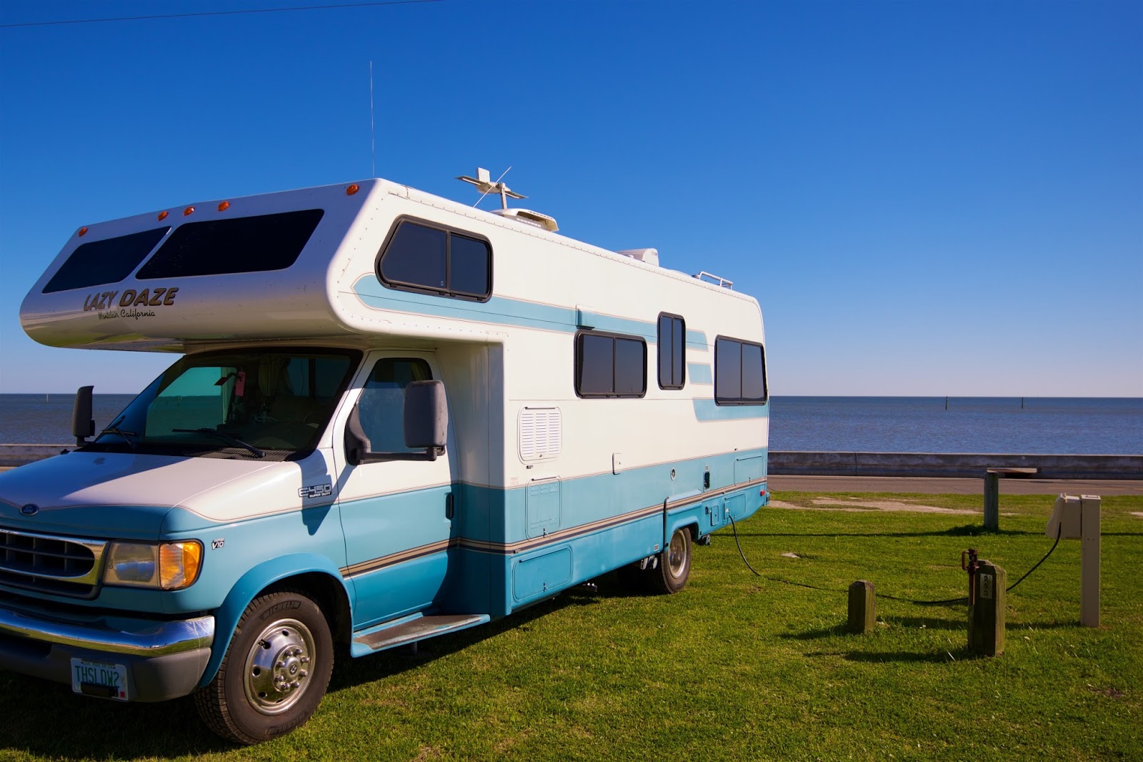
Smokeys and the Bandit?, Blue Ridge Parkway, February 2017 © Steven Crisp  [Click on the photo to enlarge]

The Great Smokey Mountains, Blue Ridge Parkway, February 2017 © Steven Crisp  [Click on the photo to enlarge]

Finally, we completed the Blue Ridge Parkway and over-heated our brakes a bit in the up and down process.  I vow to downshift more in the future.  But after cooling down, everything seemed safe again.

We used the Ultimate Campground app (by fellow LD'er Ted Houghton) to find our next campsite -- Sandy Bottoms along the Toccoa River, in the Chattahoochee National Forest, at GPS: 34.786292, -84.239739.  You'll need to cross a bridge that has a 7-ton and 10' 6" limit -- just barely enough for Thistle Dew Too.  But we made it!  This campsite has an $8 USFS camping fee.

Sandy Bottoms Recreation Area, GPS 34.786292, -84.239739, Toccoa River, Chattahoochee National Forest, Blue Ridge, GA, February 2017 © Steven Crisp  [Click on the photo to enlarge]

And here is the view from our bedroom window overlooking the Toccoa River.  Good news is that the glass is tinted so morning fishermen cannot look in ;-)

View from Our Bedroom, GPS 34.786292, -84.239739, Toccoa River, Chattahoochee National Forest, Blue Ridge, GA, February 2017 © Steven Crisp  [Click on the photo to enlarge]

So there you have it -- our first week's activities on Thistle Dew Too's Encore Adventure!  So far we have gone through NH, VT, NY, PA, WV, VA, NC, and GA.  More to follow!

Monday, February 20, 2017

Sunset on Blue Ridge Parkway

So after a wonderful time on Skyline Drive (105 miles), we thought we might as well continue along the Blue Ridge Parkway (aka BRP, another 469 miles!), which picks up right after you leave the Shenandoah National Park.  The views continued to be spectacular.  This was clearly gonna take some time ;-)

As you can see from this photo, it's pretty clear where the Blue Ridge Mountains get their name.

Literally, the "Blue Ridge Mountains", Blue Ridge Parkway, February 2017 © Steven Crisp  [Click on the photo to enlarge]

And as the day was drawing to a close, we found a nice overlook to park and watch the sun set.

Sunset on the Blue Ridge Parkway, Blue Ridge Parkway, February 2017 © Steven Crisp  [Click on the photo to enlarge]

After doing some research on-line (cellular service varies along the BRP, but can be quite good in many places), we found we were not allowed to park overnight anywhere on the BRP (even though it is not a national park).  Well, bummer.

So we did a search for nearby National Forest campsites and found one that was originally used by the CCC "boys" when they built the road.  This one is called Oronoco Campground, and had a stocked trout stream nearby.  It is located at GPS 37.746931, -79.263976. 

Oronoco Campground, GPS: 37.746931, -79.263976, Vesuvius, VA, February 2017 © Steven Crisp  [Click on the photo to enlarge]

Falling Water, Oronoco Campground, Vesuvius, VA, February 2017 © Steven Crisp  [Click on the photo to enlarge] 

Sunday, February 19, 2017

Time for a Hike

About mid-way along Skyline Drive, we stopped at the Byrd Visitor Center (which was open).  Carol almost turned me in for a new model.  I better get back to doing my pushups ;-)

Carol checks out Iron Mike, Byrd Visitor Center, Skyline Drive, February 2017 © Steven Crisp  [Click on the photo to enlarge]


John Muir's Words of Wisdom, Byrd Visitor Center, Skyline Drive, February 2017 © Steven Crisp  [Click on the photo to enlarge]

We asked here about a short scenic hike, and it was recommended that we take the Frazier Discovery Trail, which happens to briefly intersect with the Appalachian Trail.  I've often fantasized about hiking the AT, so I thought this would at least be a start ;-)

Appalachian Trail Marker, intersection with Frazier Discovery Trail, Skyline Drive, February 2017 © Steven Crisp  [Click on the photo to enlarge]

Steve Hikes the Appalachian Trail (white blaze), Skyline Drive, February 2017 © Steven Crisp  [Click on the photo to enlarge]

Enjoying my new Wide-Angle Lens, Skyline Drive, February 2017 © Steven Crisp  [Click on the photo to enlarge]

Thistle Dew Too is Sky High

So after pulling out of our driveway around 11:00 am, we had a great brunch at Aesop's Table in Peterborough, NH (just a sandwich place, but oh-so-yummy).  We headed west through Vermont and southwest through New York until we crossed the border into Pennsylvania, and spent our first night in their Welcome Center (allowed by their security).  To celebrate their first night, one of us opened a bottle of Josh Cellars Legacy Red Wine and poured it into a real wine glass.

Our first night on the road, Welcome Center, Matamoras, PA, February 2017 © Steven Crisp  [Click on the photo to enlarge]

There was still snow on the ground and quite a nip in the air, so we continued southwest through Pennsylvania, a bit of West Virginia, and intoVirginia for our first destination:  the northern entrance to Skyline Drive in Front Royal, VA.  We got there late, so after scouting out a campsite and finding them still closed tight for the season, we headed back to the Dickey Ridge Welcome Center and thought we would park there.

Dickey Ridge Visitor Center Parking (not), Northern entrance to Skyline Drive, Front Royal, VA, February 2017 © Steven Crisp  [Click on the photo to enlarge]

We were pleasantly surprised to see another RV there, so figured all was copacetic.  Well, we learned the following morning, from a park ranger visit, that no overnight parking is allowed anywhere in a National Park, unless it is a designated campsite.  He just gave us a friendly warning -- hey, we're still noobs.

Here are a few shots along the way:

Carol is HighSkyline Drive, February 2017 © Steven Crisp  [Click on the photo to enlarge]

Steven is HigherSkyline Drive, February 2017 © Steven Crisp  [Click on the photo to enlarge]

Thistle Dew Too is Sky High, Skyline Drive, February 2017 © Steven Crisp  [Click on the photo to enlarge]

We've never driven Skyline Drive (or the Blue Ridge Parkway) before, and it was beautiful and fascinating.  I never really imagined that someone could link ridgelines enough to make a road.  Let alone 574 miles of roadway!  And oh what great views to behold.  More to come.